Towns built on a swamp
Before the 1880s the Moe River flats were the Moe Swamp. VICSES's Moe River Flats guide records that the 19 kilometre Moe Drain was dug in the late 1880s to turn it into farmland, and that the flats still experience flooding on a frequent basis. The Baw Baw Heritage Study records Trafalgar forming in 1895 as the Moe Swamp Settlement while the swamp was still subject to flooding. Yarragon has the Moe River and the lowlands to its north and east and the Strzelecki Ranges rising over 500 metres immediately to the south. Darnum has the Bureau of Meteorology's river gauge on the Moe River, and the June 2021 storm brought minor flooding there and at Willow Grove.
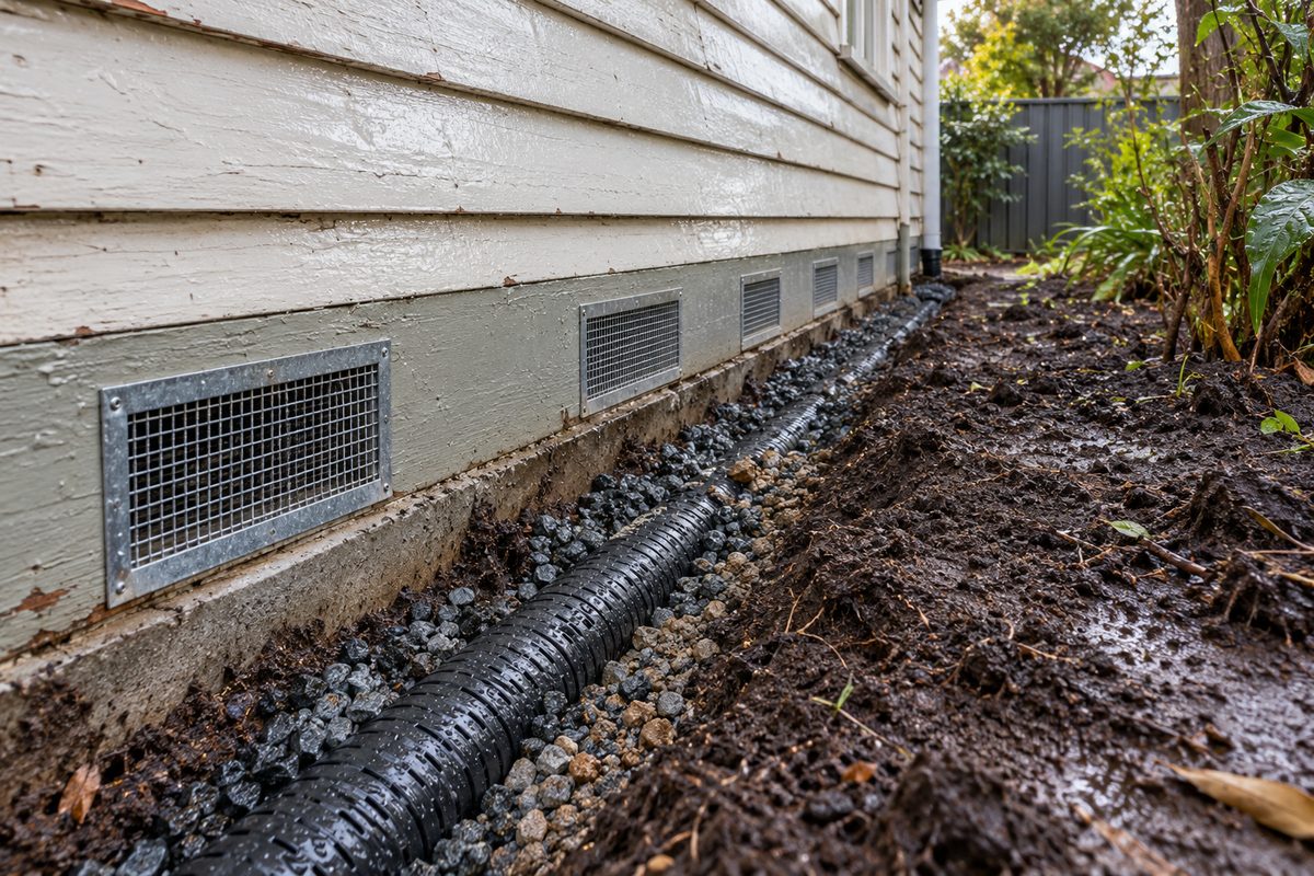
What that means for a house: the subfloor of a weatherboard in Trafalgar or Yarragon is wet for part of every winter, timber stumps rot as fast here as anywhere in the shire, the ground under the flats can move with the seasons, and the single most useful thing a restump does on this ground is put in stumps that cannot rot and drainage that gives the water somewhere else to go.
The housing
The shire's community profile says growth came to Trafalgar, along with Drouin and Warragul, in the post-war years, on top of the railway-era core. Trafalgar backs onto the Strzelecki foothills. Contingent Street and Princes Highway East form a heritage precinct. Yarragon's main street is the older timber town the highway traffic sees. Darnum and Nilma are smaller again, farmhouses and railway cottages on the flats. Across all three, much of the older stock is weatherboard on timber stumps, with low clearance on the flat ground, and the work is reblocking with drainage built in rather than added.
Flats and foothills
| Where | Ground | What it does | What the job needs |
|---|---|---|---|
| North of the highway: the flats | Drained swamp, high water table, clay in places | Stumps stand in water in winter. Where it is clay it swells and shrinks and floors come and go with the seasons. | Concrete or steel stumps set deep with wide pads, adjustable steel where the floor moves every year, grading, vents, an ag drain, sometimes a membrane. |
| The highway strip and the old town | Mixed, often filled | Rot at the ground line, previous relevels with timber packing. | Full reblock, bearers to sound timber, vents on the wet side. |
| South of the highway: the foothills | Red soil on slopes, cut-and-fill platforms, landslip country higher up | Downhill stumps on fill drop, water moves through the ground into the subfloor from uphill. | Ag drain along the uphill wall, steel stumps on the downhill side where relevelling is likely, engineer's input on anything steep. |
Landslip above Trafalgar South
The Gazette reported in January 2021 that heavy October rain had triggered landslips along five roads, including Sunny Creek Road at Trafalgar South and the Yarragon-Leongatha Road at Allambee, and the regional catchment strategy describes parts of the Strzeleckis as very prone to erosion and landslip. A house on a cut platform up those roads is not a flats job. Where the ground itself is moving, stumps are not the answer and an engineer is the first call. The hills page covers it.
The rules here
Baw Baw Shire's, the same as Warragul: a building permit from a private registered building surveyor, a Commission-registered builder at any value, an asset protection permit from council, the $10,000 contract and $20,000 Home Warranty thresholds. Two things come up more often on the flats. Flood-prone land needs council's report and consent under the Building Regulations with advice from the West Gippsland Catchment Management Authority, and the surveyor lodges it before the permit. And the heritage precinct along Contingent Street and Princes Highway East in Trafalgar means a contributory house gets a planning check first. The overlays page explains both.
Timing
Late summer and autumn. Ellinbank's long record puts September, July and August over 110 mm each and February at 46 mm. A hole dug beside a Yarragon stump in August has water in it by the time the stump is out. The same hole in March is dry, the clay is at its driest, and the crew sees the house at its lowest point, which is the right point to level from.
What cannot be fixed on the flats
The water table. A house on the old swamp will have a damp subfloor in winter whatever is done, and the aim is stumps that do not mind and drainage that keeps it from pooling. The clay. It will move; deeper stumps, wider pads and adjustable heads manage it, they do not stop it. And the flood maps, which council abandoned updating in 2022 because the estates upstream had changed the drainage; a house near the Moe River is treated as flood-affected whatever VicPlan shows.
Check the current rules before you rely on this
This page describes restumping on the Moe River flats and the Strzelecki foothills around Trafalgar, Yarragon and Darnum in Baw Baw Shire. It describes the rules in general terms as they stood in October 2026. Standards, forms, thresholds and fines change.
The authoritative sources are VICSES Moe River Flats local flood guide, VICSES flood guide for Baw Baw Shire, Baw Baw Heritage Study, VICSES presentation on the June 2021 storm, Baw Baw community meeting, Warragul and Drouin Gazette, January 2021, on landslips after October rain and Baw Baw Shire Council on report and consent. Where anything here differs from those sources, they are right and we are not.
We are not building surveyors, engineers, planners or lawyers. For what applies to your house, ask a registered building surveyor or ring Baw Baw Shire Council on 03 5624 2411.
Accurate at the time of writing, October 2026. Always check the source before relying on it.